
In recent years, the construction of cross-river and cross-sea passages in the Guangdong-Hong Kong-Macao Greater Bay Area has developed rapidly. The passage networks play a significant role in building and improving the comprehensive three-dimensional transportation network in the Greater Bay Area, as well as promoting deeper integration and development in the region.

An aerial drone photo taken on July 3, 2024 shows vehicles running on the Shenzhen-Zhongshan link in South China's Guangdong province.
An aerial drone photo taken on June 3, 2015 shows a view of the Humen Bridge, which links Guangzhou city and Dongguan city, in South China's Guangdong province. (Xinhua)
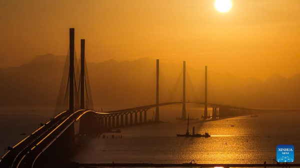
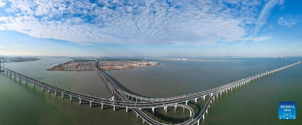
An aerial drone photo taken on December 4, 2024 shows a view of Gaolan Port Bridge (with twin main towers on the left) and Huangmao Sea Channel Bridge (with three main towers on the right) in South China's Guangdong province.
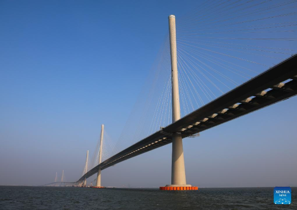
This photo taken on December 7, 2024 shows a view of Gaolan Port Bridge (with twin main towers on the left) and Huangmao Sea Channel Bridge (with three main towers on the right) in South China's Guangdong province.
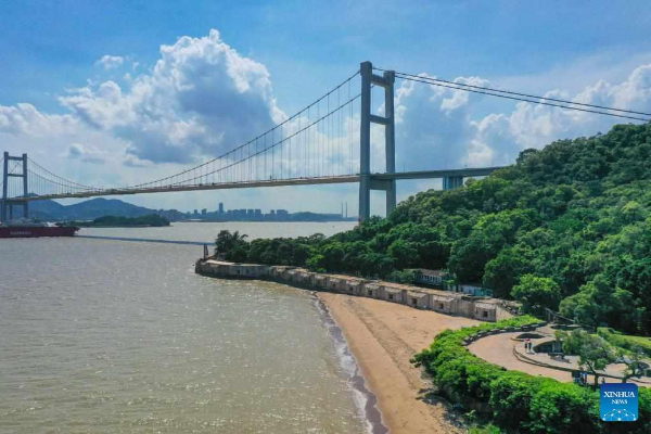
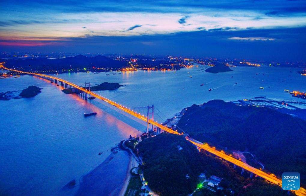
An aerial drone photo taken on June 23, 2020 shows a view of the Humen Bridge, which links Guangzhou city and Dongguan city, in South China's Guangdong province.
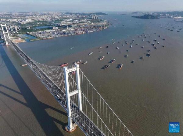
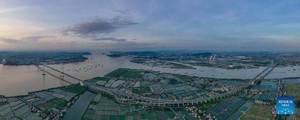
An aerial drone photo taken on October 2, 2024 shows a view of the Nansha Bridge, which links Guangzhou city and Dongguan city, and ships along the Shiziyang channel in the Pearl River Estuary area, in South China's Guangdong province.
An aerial drone photo taken on October 2, 2024 shows a view of an interchange overpass on the Nansha Bridge, which links Guangzhou city and Dongguan city, in Haiou Island of the Pearl River Estuary area in Guangzhou, South China's Guangdong province.
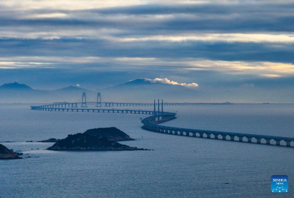
An aerial drone photo taken on December 15, 2023 shows a view of the Hong Kong-Zhuhai-Macao Bridge in South China.
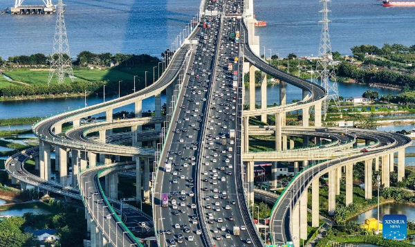
An aerial drone photo taken on November 27, 2024 shows the Wanqingsha Branch Line connecting with the Shenzhen-Zhongshan link in South China's Guangdong province.
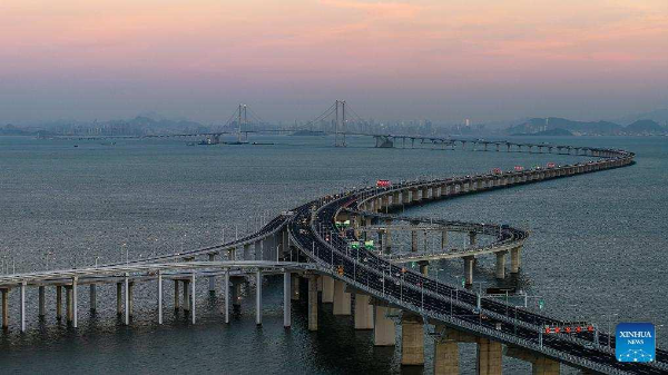
An aerial drone photo taken on November 27, 2024 shows the Wanqingsha Branch Line connecting with the Shenzhen-Zhongshan link in South China's Guangdong province.
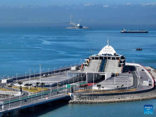
An aerial drone photo taken on December 15, 2023 shows the eastern artificial island and western artificial island of the Hong Kong-Zhuhai-Macao Bridge in South China.
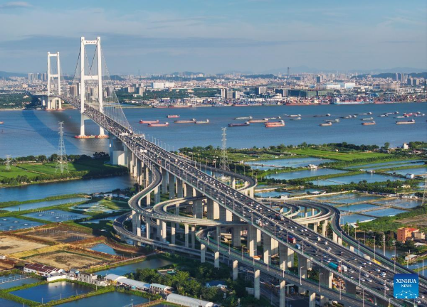
An aerial drone photo taken on October 2, 2024 shows a view of the Nansha Bridge, which links Guangzhou city and Dongguan city, and ships along the Shiziyang channel in the Pearl River Estuary area, in South China's Guangdong province.
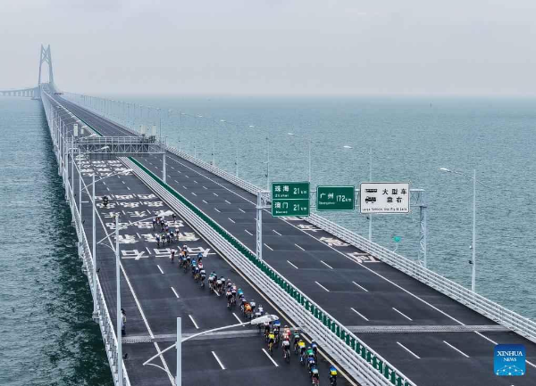
An aerial drone photo taken on November 24, 2024 shows athletes participating in a cycling race passing through the Hong Kong-Zhuhai-Macao Bridge in South China.
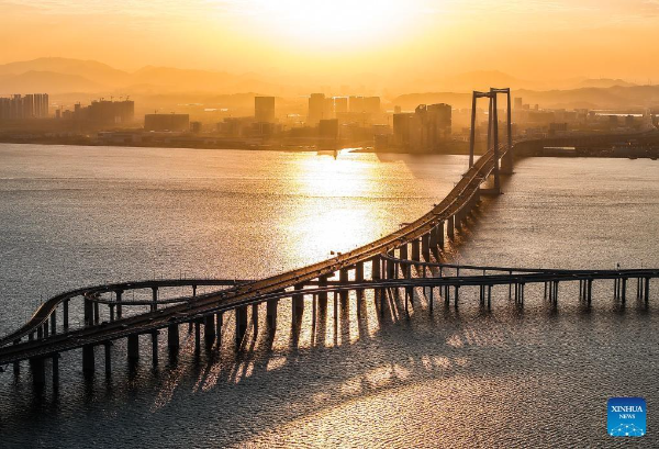
An aerial drone photo taken on November 27, 2024 shows the Wanqingsha Branch Line connecting with the Shenzhen-Zhongshan link in South China's Guangdong province.
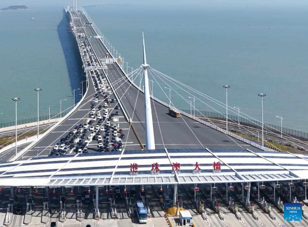
An aerial drone photo taken on February 12, 2024 shows vehicles on the Hong Kong-Zhuhai-Macao Bridge in South China. (Xinhua)
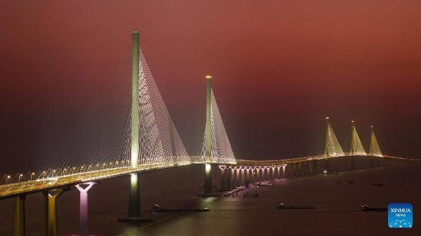
An aerial drone photo taken on December 7, 2024 shows a view of Gaolan Port Bridge (with twin main towers on the left) and Huangmao Sea Channel Bridge (with three main towers on the right) in South China's Guangdong province.
An aerial drone photo taken on June 29, 2022 shows a view of the Nansha Bridge, which links Guangzhou city and Dongguan city in South China's Guangdong province.
All materials marked with "source: English.gz.gov.cn" on this website (including but not limited to text, photographs, audio and video materials) are the copyrighted property of Guangzhou International (the official website of Guangzhou Municipality). Without prior authorization from Guangzhou International, any media, website, organization or individual shall not transmit, interlink, distribute or republish such materials in any form. Any media and website authorized to republish such materials shall mark them with "source: Guangzhou International (English.gz.gov.cn)". Infringement of these copyrights will result in legal action.